We create hundreds of animated and still graphics every day using output from our own weather models as well as from other publicly available data. The samples below showcase the spectrum of our current products with largely varying time and space scales.
We welcome the opportunity to create new tailored products as needed under consultation.
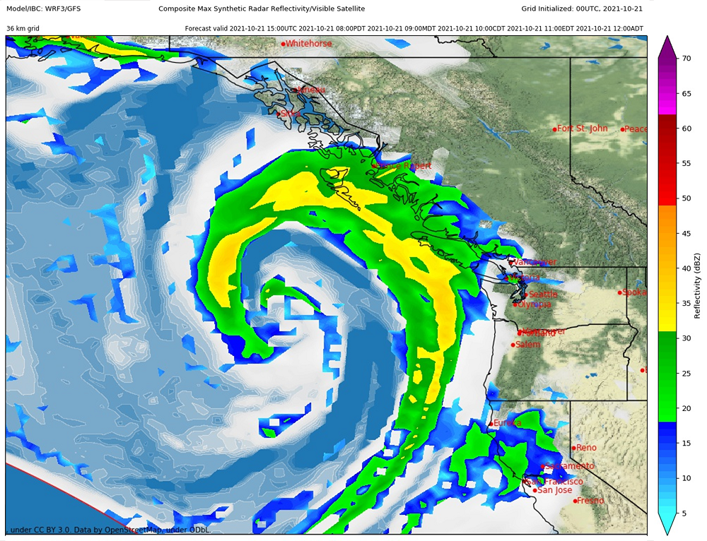
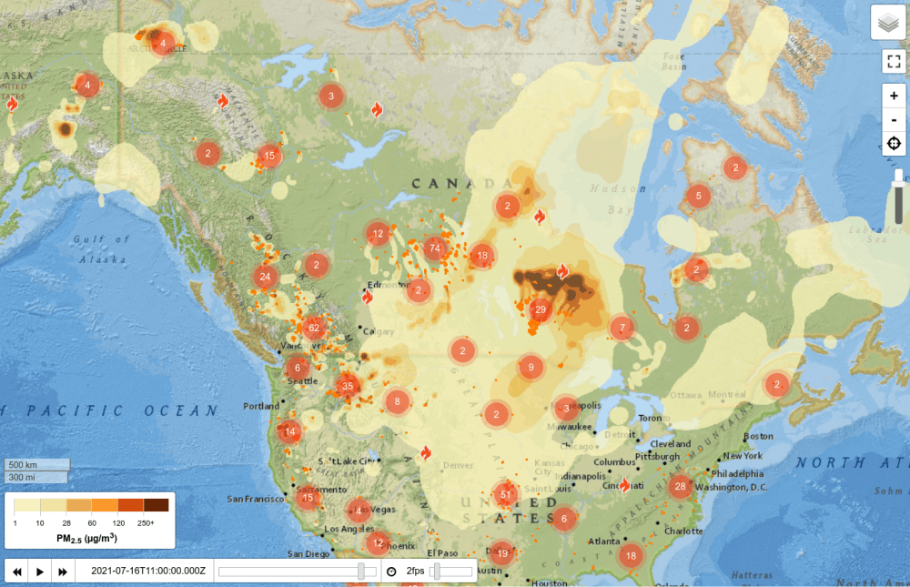
Synthetic Satellite and Radar
Large scale forecast maps
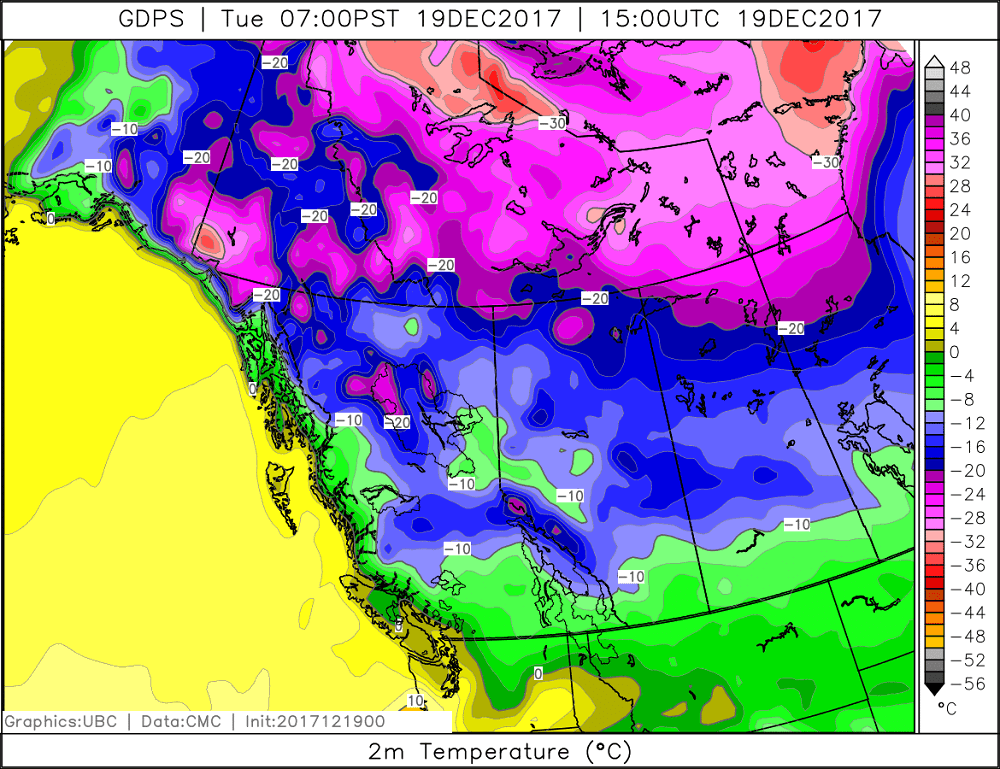
Temperature
Large scale forecast maps
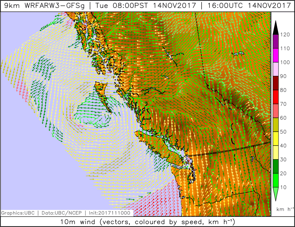
Wind
Large scale forecast maps
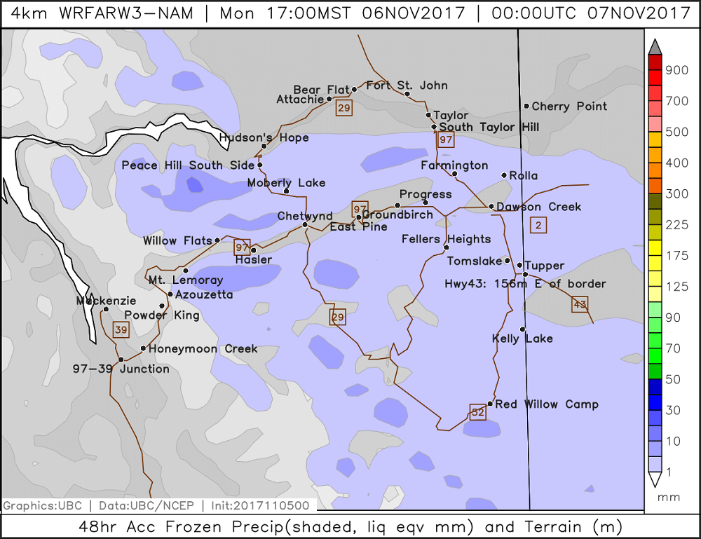
Snowfall
High-resolution forecast maps
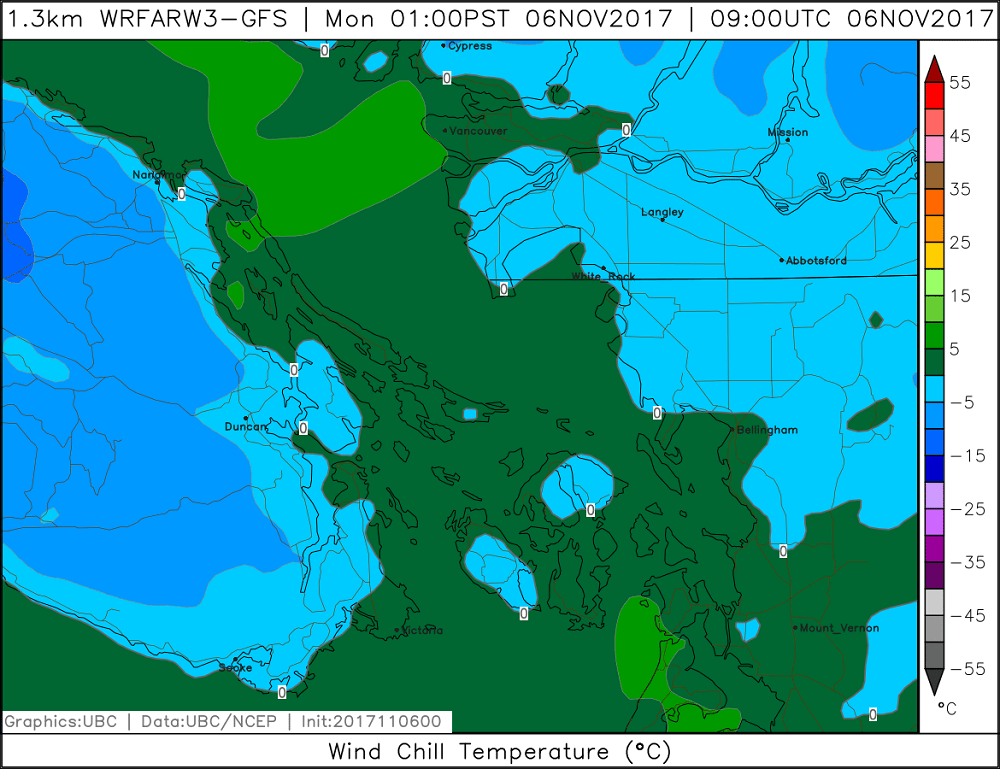
Wind Chill Temperature
High-resolution forecast maps
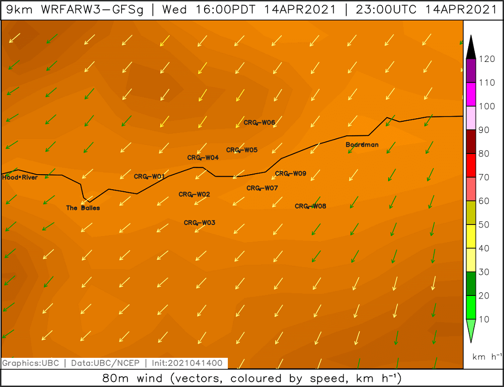
Hubheight Wind
High-resolution forecast maps
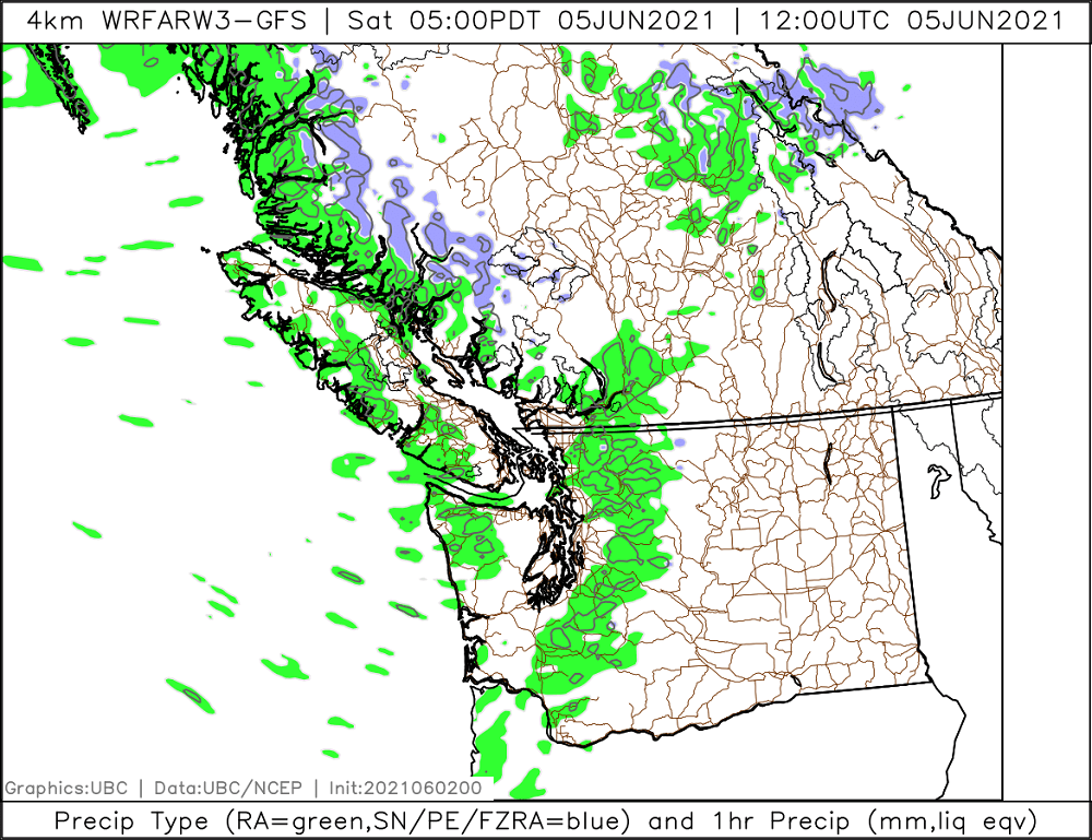
Precipitation Type
Forecast maps
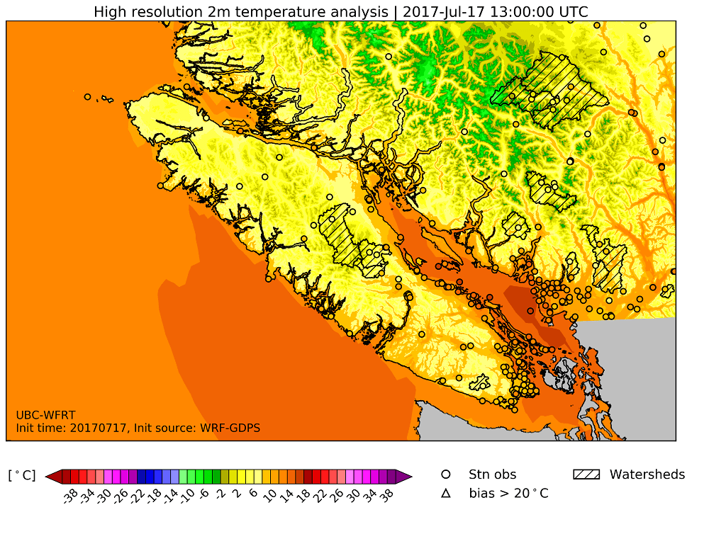
Temperature Analysis
Analysis maps
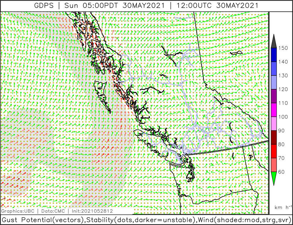
Gust Potential
Forecast maps
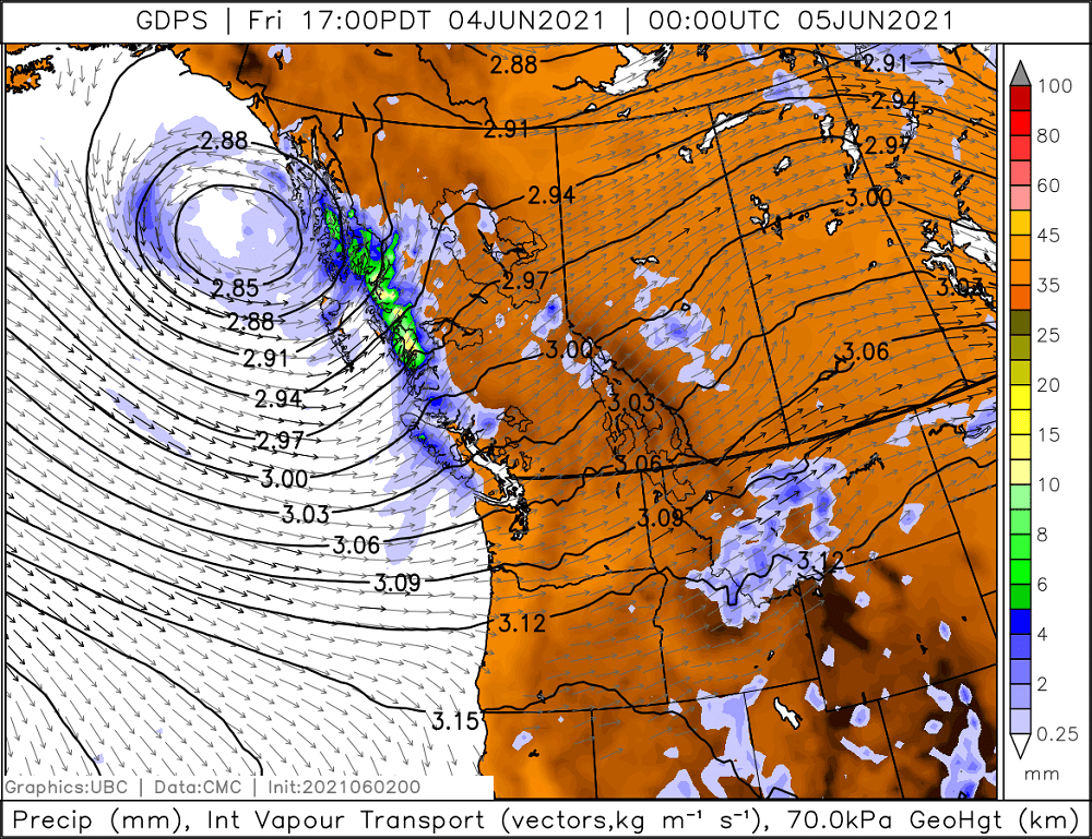
Precipitation, Integrated Water Vapor & Geopotential Height
Multi-variable maps
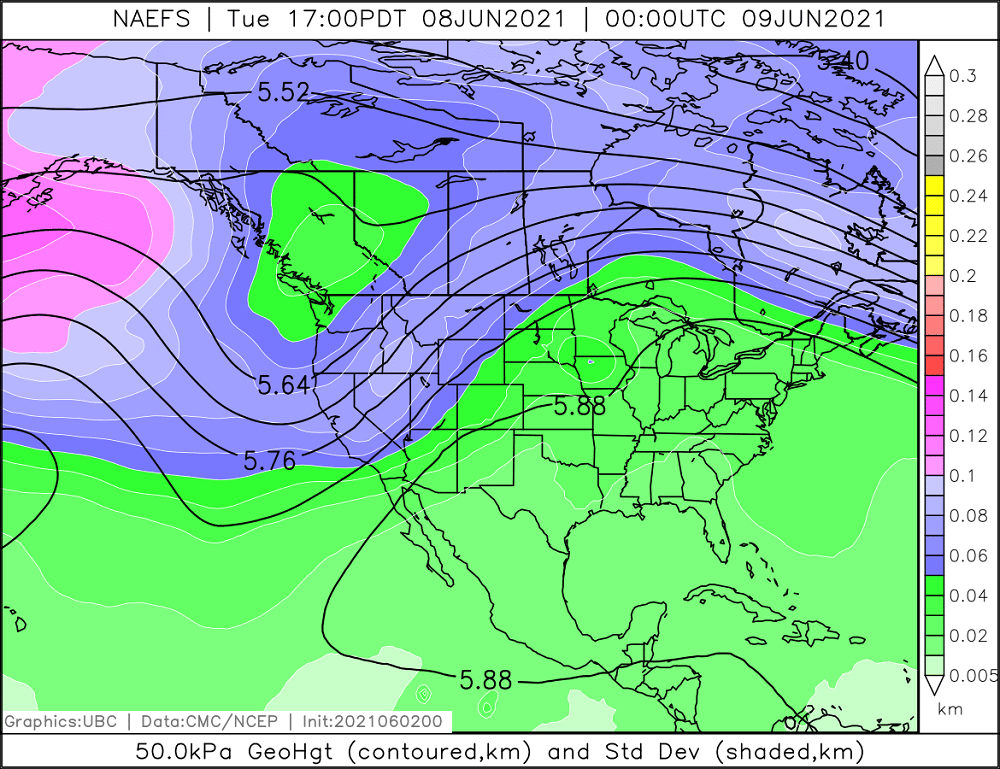
Geopotential Height & Ensemble Standard Deviation
Multi-variable maps
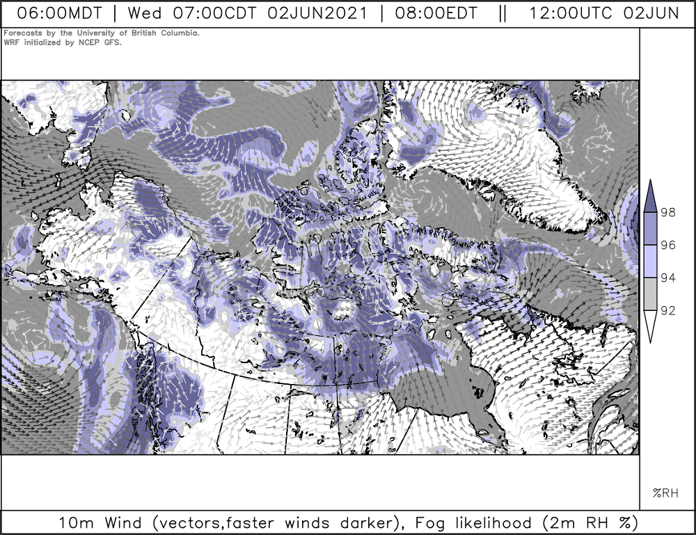
Wind & Fog Likelihood
Multi-variable maps
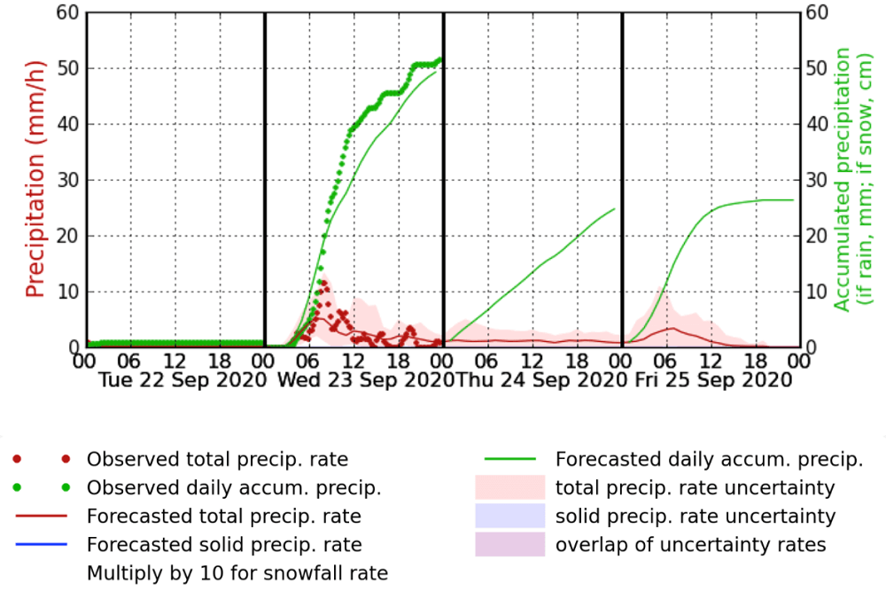
Precipitation
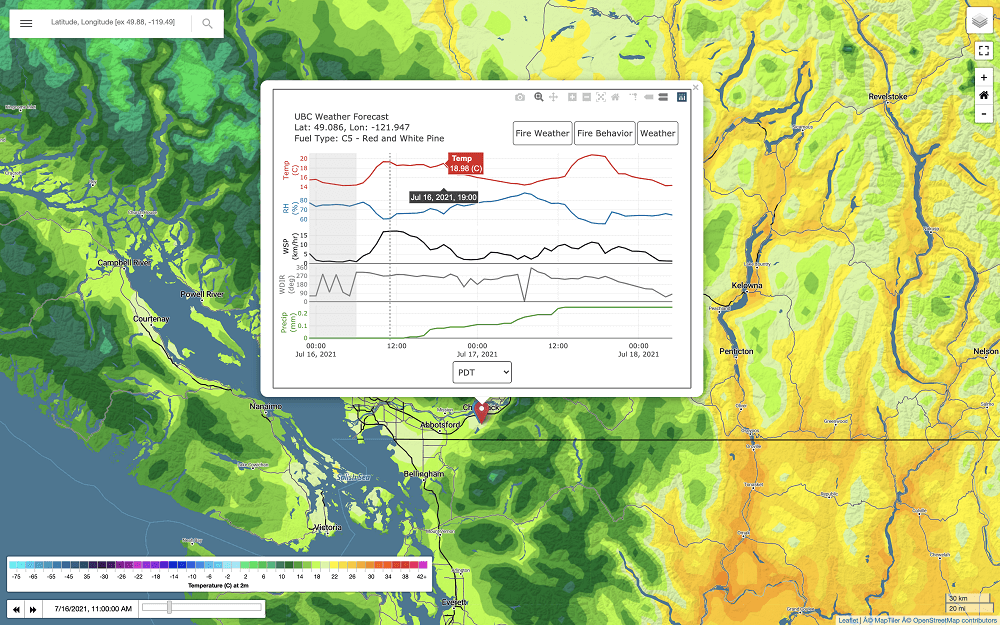
Point forecast meteograms
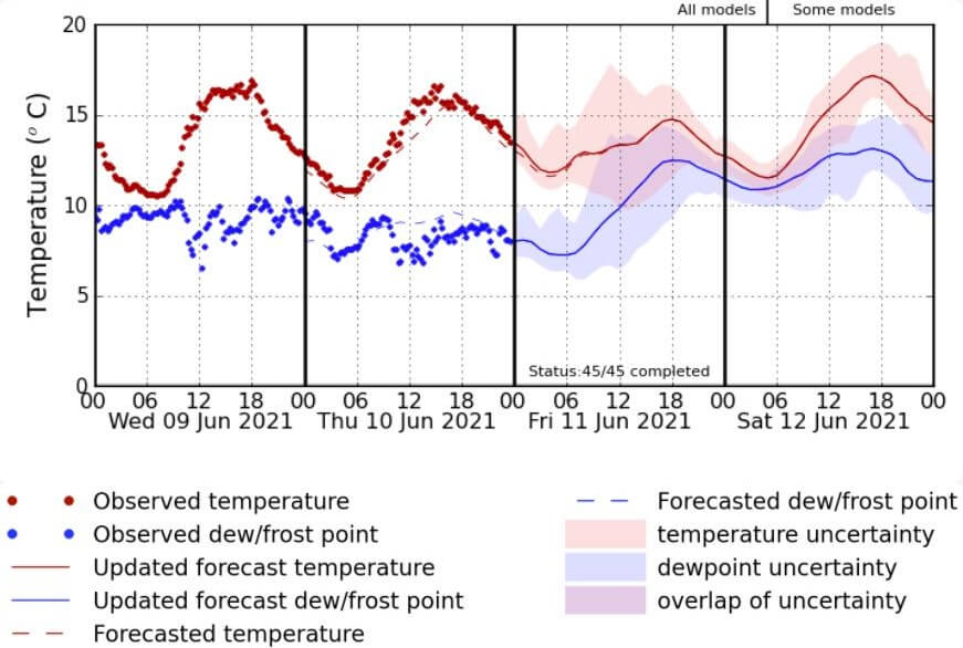
Temperature
Point forecast meteograms
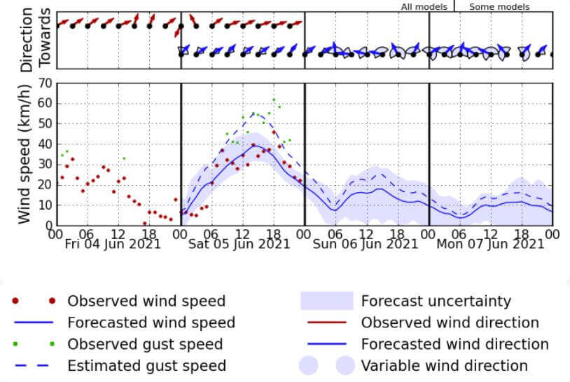
Wind
Point forecast meteograms
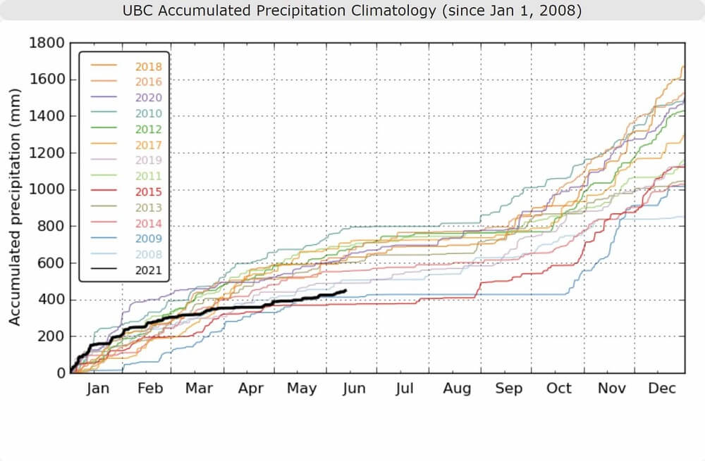
Accumulated Precipitation
Climatology
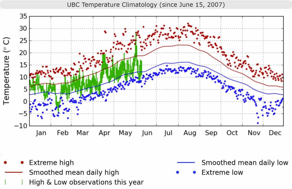
High & Low Daily Temperature
Climatology
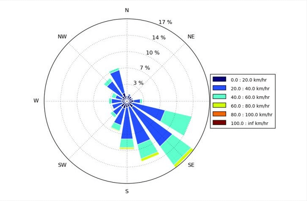
Wind Rose
Climatology
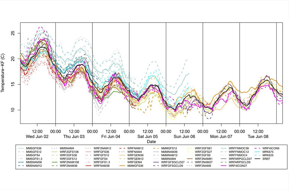
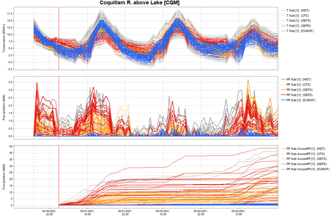
Spaghetti Plot
Ensemble member comparison
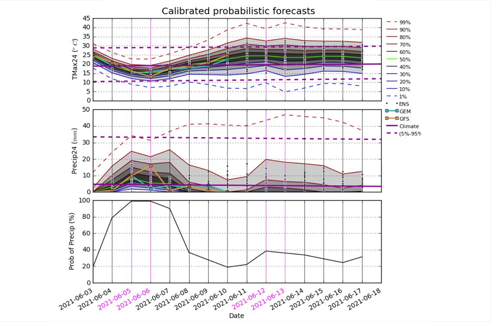
Probabilistic Forecasts